Map - Central Greece (region) (Central Greece)

Central Greece  (Central Greece)
Central Greece (Περιφέρεια Στερεάς Ελλάδας,, colloquially known as Ρούμελη (Roúmeli)) is one of the thirteen administrative regions of Greece. The region occupies the eastern half of the traditional region of Central Greece, including the island of Euboea. To the south it borders the regions of Attica and the Peloponnese, to the west the region of West Greece and to the north the regions of Thessaly and Epirus. Its capital city is Lamia.

The region was established in the 1987 administrative reform. With the 2010 Kallikratis plan, its powers and authority were redefined and extended. Along with Thessaly, it is supervised by the Decentralized Administration of Thessaly and Central Greece based at Larissa. The region is based at Lamia and is divided into five regional units (pre-Kallikratis prefectures), Boeotia, Euboea, Evrytania, Phocis and Phthiotis, which are further subdivided into 25 municipalities.

 
Map - Central Greece  (Central Greece)
Map
Openstreetmap - Map - Central Greece (region)
Openstreetmap
sterea_central.jpg
1564x2174
www.alpha-omegaonlin...
sterea-8a.jpg
1542x2168
www.hri.org
macedonia_central.jp...
1537x2174
www.alpha-omegaonlin...
CentralGreece.jpg
1789x1300
rolfgross.dreamhoste...
greece-map-167.jpg
922x1357
www.sailingissues.co...
map_a_central.jpg
1619x719
www.greekcamping.gr
Inselplan-E%C2%B4via...
1000x1000
www.hot-map.com
map-ancient-central-...
1031x765
www.greeceathensaege...
map-ancient-central-...
1031x765
www.harrys-greece-tr...
Image51.jpg
911x827
rolfgross.dreamhoste...
central-greece-map.p...
796x544
www.sailingissues.co...
central_greece_map.p...
796x544
2.bp.blogspot.com
6.gif
729x370
www.gocamping.gr
psiri-map.jpg
519x491
harrys-greece-travel...
map-attica-central-g...
595x383
www.grece-bleue.net
map-of-central-greec...
580x368
3.bp.blogspot.com
map-central-greece.g...
580x368
www.greeceathensaege...
map-of-central-greec...
600x281
www.map-of-greece.co...
Central_Greece_Map+G...
600x281
4.bp.blogspot.com
map-central-greece.g...
575x288
www.justgreece.com
Country - Greece
Flag of Greece
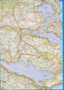
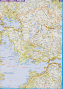
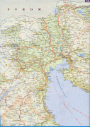
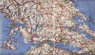
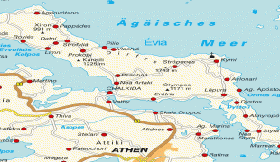
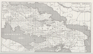
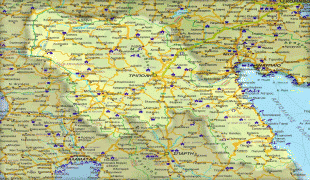
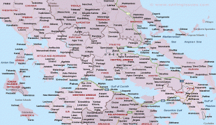
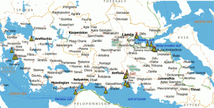
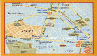
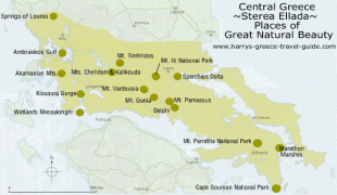
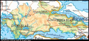
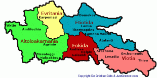
Greece, officially the Hellenic Republic, is a country in Southeast Europe. It is situated on the southern tip of the Balkan Peninsula, and is located at the crossroads of Europe, Asia, and Africa. Greece shares land borders with Albania to the northwest, North Macedonia and Bulgaria to the north, and Turkey to the northeast. The Aegean Sea lies to the east of the mainland, the Ionian Sea to the west, and the Sea of Crete and the Mediterranean Sea to the south. Greece has the longest coastline on the Mediterranean Basin, featuring thousands of islands. The country consists of nine traditional geographic regions, and has a population of approximately 10.4 million. Athens is the nation's capital and largest city, followed by Thessaloniki and Patras.

Greece is considered the cradle of Western civilization, being the birthplace of democracy, Western philosophy, Western literature, historiography, political science, major scientific and mathematical principles, theatre and the Olympic Games. From the eighth century BC, the Greeks were organised into various independent city-states, known as poleis (singular polis), which spanned the Mediterranean and the Black Sea. Philip II of Macedon united most of present-day Greece in the fourth century BC, with his son Alexander the Great rapidly conquering much of the ancient world, from the eastern Mediterranean to the North Western parts of India. The subsequent Hellenistic period saw the height of Greek culture and influence in antiquity. Greece was annexed by Rome in the second century BC, becoming an integral part of the Roman Empire and its continuation, the Byzantine Empire, which was culturally and linguistically predominantly Greek.
Currency / Language  
ISO Currency Symbol Significant figures
EUR Euro € 2
Neighbourhood - Country  
  •  Turkey 
  •  Albania 
  •  Bulgaria 
  •  Republic of Macedonia 
Administrative Subdivision
Country, State, Region,...